Saturday, October 3rd, 2009
This post is about navigation. Actually, it’s about navigating the Route by printed book and map, while driving a standard vehicle that’s towing a trailer, while handling a time-lapse camera, while trying to look around and actually see what you are driving past.

signs indicating two different alignments to be followed: pre-1930 to the left, post-1930 to the right
Route 66 may sound like it’s pretty easy to follow. It’s not. Not really, if only one set of eyes are in the car, and they’re driving (and doing all the other stuff I mentioned above… and, no comments about female drivers – I assure you, I am an excellent navigator.) The Route is signed, but not 100% of the time. The Route can also have more than one sign – meaning, if you go this way, you’ll be on a version of the Route that dates from this time period; go left, and you’ll be on a later alignment of the Route. If you think about it, it makes sense: over the decades, as populations grow and traffic increases, roads change to accommodate flow, pedestrian safety, etc. There are various alignments of Route 66, and often times you see the older version of it, closed and covered with weeds, running alongside of the road you’re actually on.

driving the route alongside the original Route 66 concrete, now closed to traffic
Other times, it branches off and goes into a dead-end. Other times you end up on the interstate highway because it either covers the original road, or the original road was demolished, or there simply isn’t any other way to get from A to B without going on the interstate at that particular spot.
Before I go any further, I need to give credit to an invaluable source I am relying on during this trip. My friend Ben Willmore highly recommended I get a copy of “E-Z 66 Guide for Travelers” by Jerry McClanahan, and that is the version of Route 66 that I am traveling. It’s the easiest way for me to follow the road, and I figure most people would follow the same route that’s in that guide too. The book actually gives you options where there is more than one alignment (e.g., “1926-1930” vs. “post-1930”), so you can choose as you go. I am generally sticking with the main route he plots out. At the same time, I am relying upon those little “Historic Route 66 Byway” signs to confirm I am turning at the right spots, since the book doesn’t give you distances between turns and sometimes there aren’t any street signs. I sometimes turn on Sasha (the GPS) so I can glance over to see if the turn in the book is coming up.

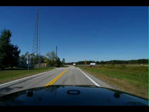
Those are "road closed" signs in the background. I doubled-back 10 miles to where the closure ended to keep the time-lapse as accurate as possible. It didn't occur to me until later that the entire 10 mile stretch was right alongside the interstate that I had just travelled, so the view would have been the same from there, pretty much. I really didn't have to drive it three times.
Here’s a thing about those “Historic Route 66” signs along the road: not only are they sporadic at times – but occasionally they contradict the route in the book. I have no idea which is “correct” at those instances – probably both are – but it sure sucks when you’re coming up to a sign that says to turn when the book clearly says to “stay ahead”.
…that’s another thing. If I were giving you directions, and I said to “stay ahead”, what would you do? For the love of God, what does “STAY AHEAD” mean?? I love this E-Z Guide but – stay ahead?? You probably guessed it means “go straight”, and that is what I eventually sussed out too… but it sure had me confused at first. The other thing about this (again: really great book, I mean it!) is the cardinal directions used to denote highways. Now, if I-70 seems to pretty much go in a north-south direction at some point, and you want me to go south, I can see why you’d say “take I-70 SOUTHBOUND”. But see, note the signs that point to the highway exits? They may not agree with the whole north-south thing. They believe that the highway actually goes east-west. So I ask you: if I am looking for the exit to I-70 SOUTH, and I see exits for I-70 WEST and I-70 EAST… what do I do???? (Well, I yell “F*CK?!?!?”, miss the turn, stop the damn time-lapse camera, give apologetic signals to the annoyed drivers around me, try to turn around but get the trailer stuck in some small apartment building’s parking lot, ignore the kids who are laughing at me trying to get out of the jackknife, find somewhere to pull over, check the maps to figure out which friggin exit I should take (does south = east?? Yes), go back into the camera and delete the pictures that were snapped after the missed turnoff, reset the camera to accept the remote signal again, take a test shot, delete it, try to find my way back to where I was, and attempt to re-start the time-lapse camera as close as possible to where I left off before, while looking for the exit I should have taken in the first place.)
That particular instance will explain my sarcastic comment earlier about St.Louis being a treat to get through.
Here’s a short time-lapse sequence of the Route driven today. You can see that it branches away from the interstate for a short bit but then returns to it again.
It’s so late!! Need to get to bed (er, air mattress) so I can make it to Afton to meet up with Tattoo Ron tomorrow.
